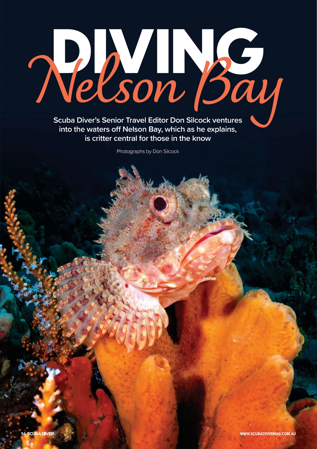
Diving Nelson Bay… Every region seems to have at least one… In Indonesia it would have to be the Lembeh Strait in North Sulawesi. And in Papua New Guinea it’s either Dinah’s Beach or Samarai Jetty in Milne Bay. While over in Florida it is West Palm Beach’s Blue Heron Bridge.
Here in New South Wales, it’s Nelson Bay. The wonderfully picturesque town located on the southern shore of Port Stephens. About an hour north of Newcastle on the state’s central coast.
We are talking renowned critter sites… Where the smaller, colorful, and incredibly photogenic creatures of the oceans seem to gather. And concentrated in a relatively small area along Nelson Bay’s foreshore are a couple of exceptional sites that showcase the wonderful temperate and tropical marine diversity of eastern Australia.
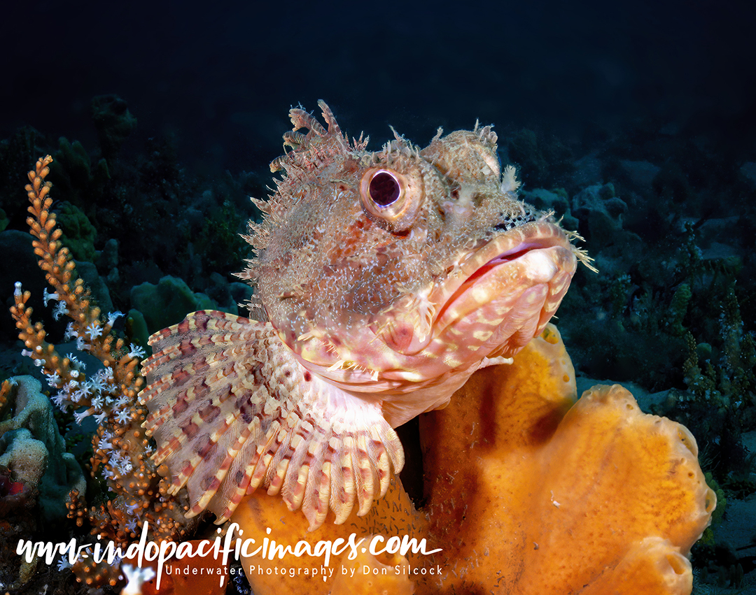
Diving Nelson Bay – Port Stephens 101…
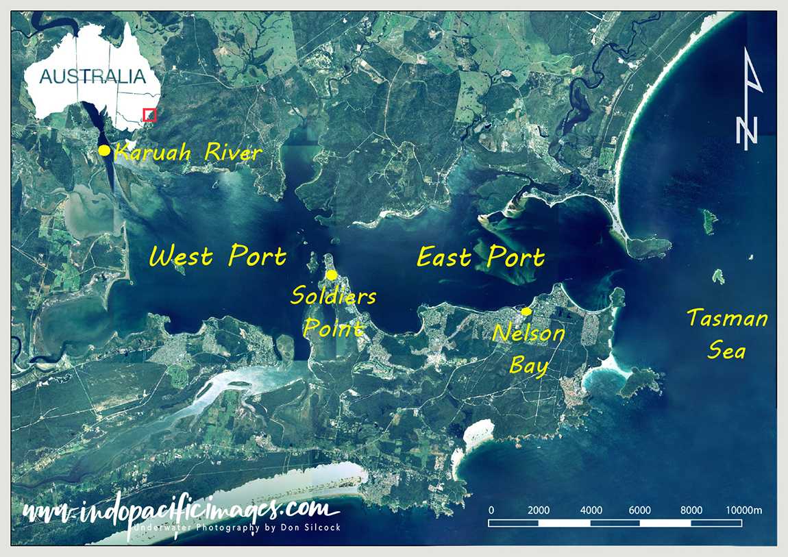
Located some 220km north of Sydney. Port Stephens is a large, drowned-valley, estuary that covers a total area of some 134 km2. Almost 2.5 times larger than Sydney Harbor!
There are many things that are special about Port Stephens, but let’s start with its geomorphology… The shape and structure of the two large lobes, or ports, that make up the bay area.
Together with the relatively narrow and shallow mouth of the estuary where it discharges into the Tasman Sea. The bay is divided roughly in to two by the Soldiers Point peninsular.
And the inner, western port is the immediate catchment area for the large fresh-water Karuah River. Which rises in the Barrington Tops National Park and means the west port has a mainly estuarine ecology.
While the outer, eastern port receives most of its water from the twice-daily incoming tides from the Tasman Sea. And has a predominantly marine ecology.
With a maximum depth of just 40m, abundant sunshine and a benign, sheltered location. Port Stephens provides a superb environment for biodiversity to thrive. With studies showing that it is home to over 400 species of fish, 200+ species of nudibranchs plus numerous cuttlefish, octopus and squid. Together with rich sponge gardens and temperate water soft corals. But the real key to understanding why Port Stephens has some incredible biodiversity hotspots are those incoming waters from the Tasman Sea…
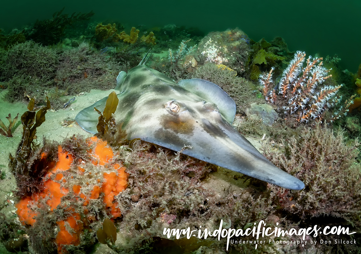
The EAC MixMaster!
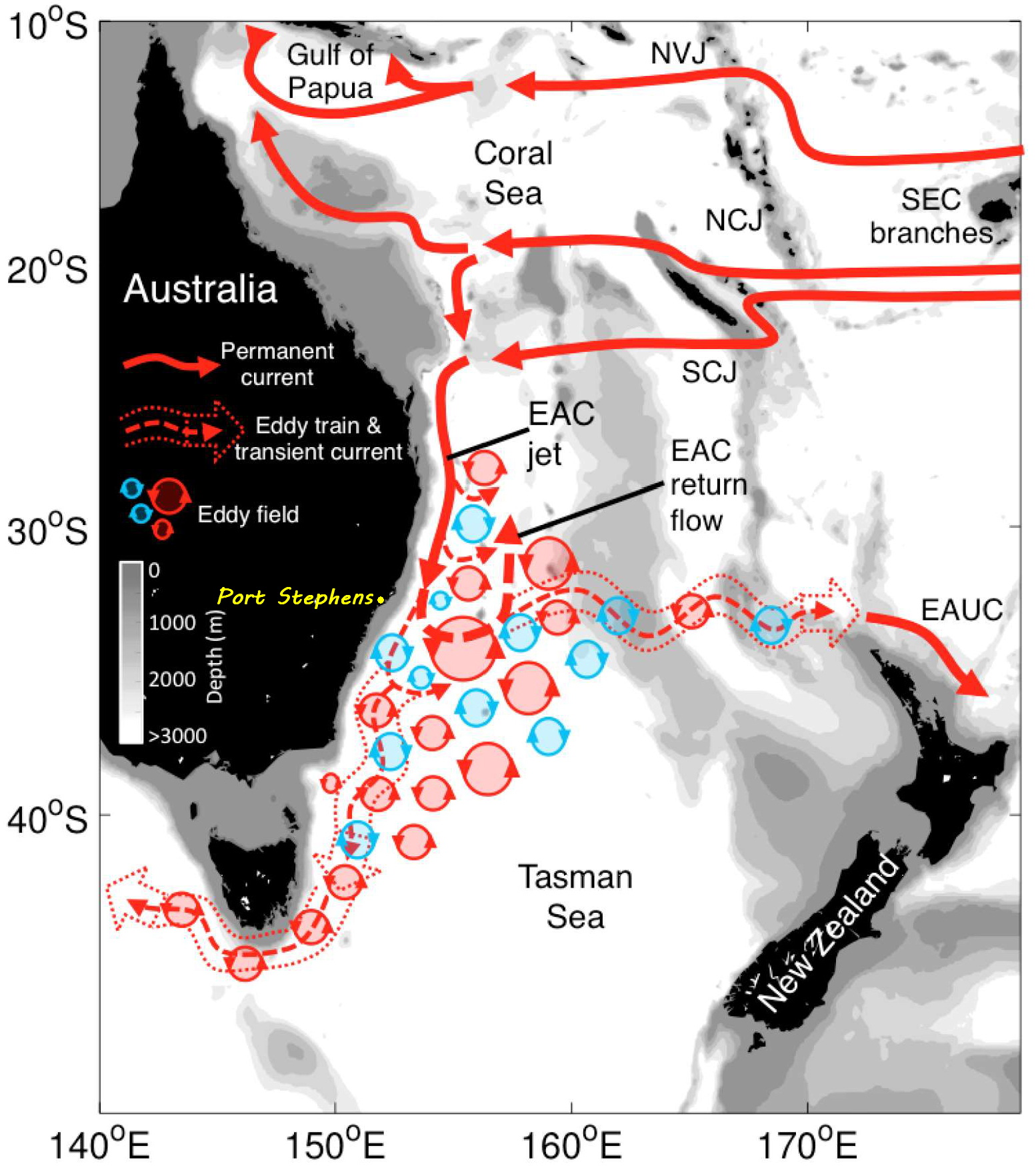
Usually referred to by its acronym, the EAC forms in northern Queensland where the Pacific Ocean’s Southern Equatorial Current (SEC) meets the continental shelf and splits into two.
With the southern split becoming the Eastern Australian Current and then surging down the east coast of the continent.
The EAC is both the largest and strongest movement of water in Australia. And, at times, is up to 100km wide, 500m deep and reaches speeds of almost 4 knots. Although not particularly rich in nutrients, it does however transport huge quantities of warm water from the north.
And where those waters meet the colder ones from the south, it creates the basic mechanism that enables rich biodiversity – upwellings…
Virtually everything that dies in the sea descends to the bottom. Where it decomposes and creates a dense, rich layer of phosphorous and nitrogen-based nutrients. When warm surface waters are displaced by wind or currents, they are replaced with cold water rising from the depths, which suck up those rich nutrients.
The Tasman Sea between south-east Australia and New Zealand is where the warm waters of the EAC meet the cold waters from the south. Creating “eddy fields” which are at their most active offshore from northern NSW.
Placing Port Stephens right in the eye of an incredible hydrodynamic phenomenon. And those twice daily incoming tides deliver a potent brew of nutrients from the deep. Mixed with the northern tropical and southern temperate larvae of eastern Australia.
Nelson Bay 101…
If you stand on Nelson Head, with the old lighthouse behind you and look down at the east port of Port Stephens. The wonder of this special part of NSW is displayed before you in all its scenic splendor!
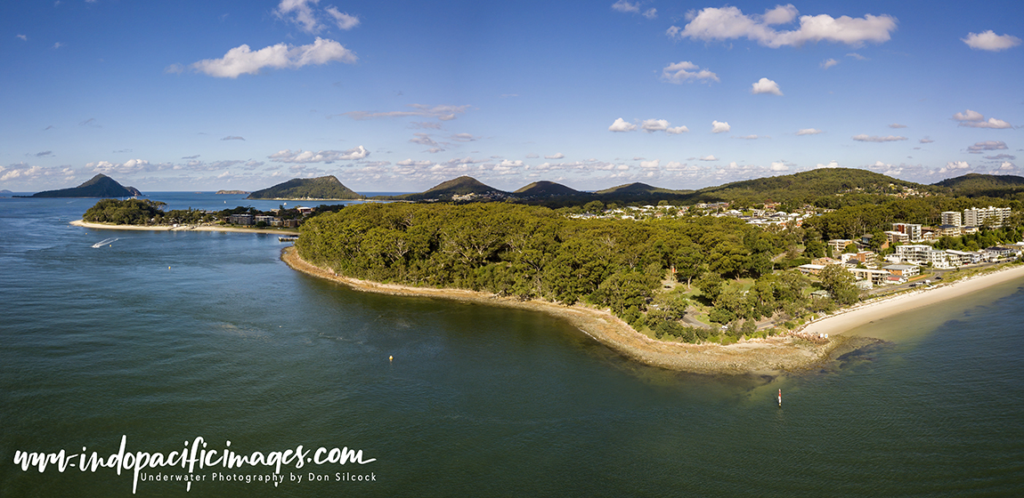
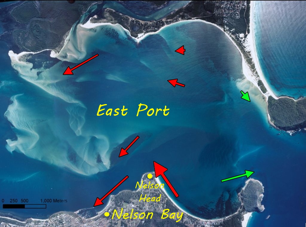
But look closer, down at the waters flowing into the east port. And you will start to understand why certain parts of Nelson Bay have such incredible biodiversity.
The bathymetry (underwater landscape) of Port Stephens is a complex thing. With large areas of shallow sand banks and deeper channels. Those rich tidal waters will always follow the path of least resistance through the channels and the deepest one is right in front of you…
Because of its huge size, complex bathymetry and relatively narrow and shallow estuary mouth. The tidal flows in and out of Port Stephens are fierce and positively dangerous if underestimated.
Viewed at their peak, as they surge around Nelson Head. Those tides are an awesome sight to behold.
And after rounding Nelson Head those waters flow along the southern shore of the east port.
Past the small bays that are home to the biodiversity hotspots Nelson Bay is renowned for. That flow of tidal water creates eddies which deliver the rich nutrients and larvae to the hotspots enabling them to thrive and pulse with biodiversity!
Diving Nelson Bay – The 2021 Floods
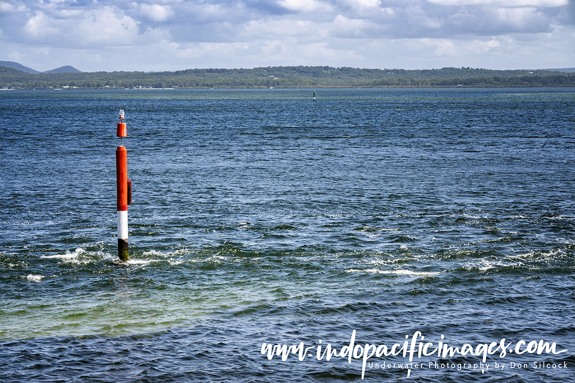
Over a period of several days in March this year NSW experienced some of the heaviest rainfall on record.
In the Port Stephens area 457mm fell in just three days. The highest total recorded since records were first taken in 1889.
Such a massive volume of fresh water, carrying with it large amounts of pesticides and herbicides, dramatically changed both the chemical composition and salinity of the water flowing through Port Stephens.
The result was an almost “neutron bomb-like” destruction of all marine life down to about 6m depth! Thankfully the marine life down deeper was not severely impacted. As the lighter fresh water floated as a layer on top of the denser sea water…
Initially, at least there was great concern that the damage was so bad recovery was out of the question.
But nature is a powerful thing, and the signs are very positive that the balance will be restored. And by next year much of that marine growth will have returned.
Diving Nelson Bay – Halifax Park
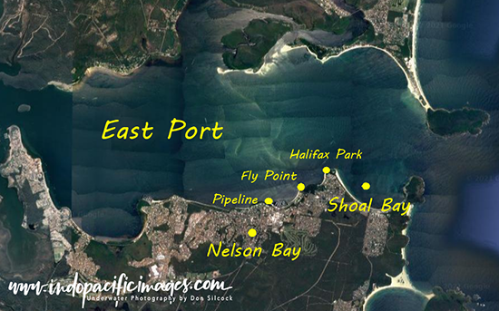
There are three well-known hotspots along that southern shore – Halifax Park, Pipeline and Fly Point.
Halifax Park site was generally considered as one of the very best shore dives in Australia. Because of its stunning sponge gardens and the extraordinary amount of marine life to be found there.
Then sadly from around 2005 the sand came… Divers noted increasing amounts of sand being deposited on the shallower parts of the site. And then over a number of years much of those incredible gardens.
Rarely dived these days, Halifax is a distant shadow of its former self.
The whole topic of where the sand came from is a very emotive subject in Nelson Bay.
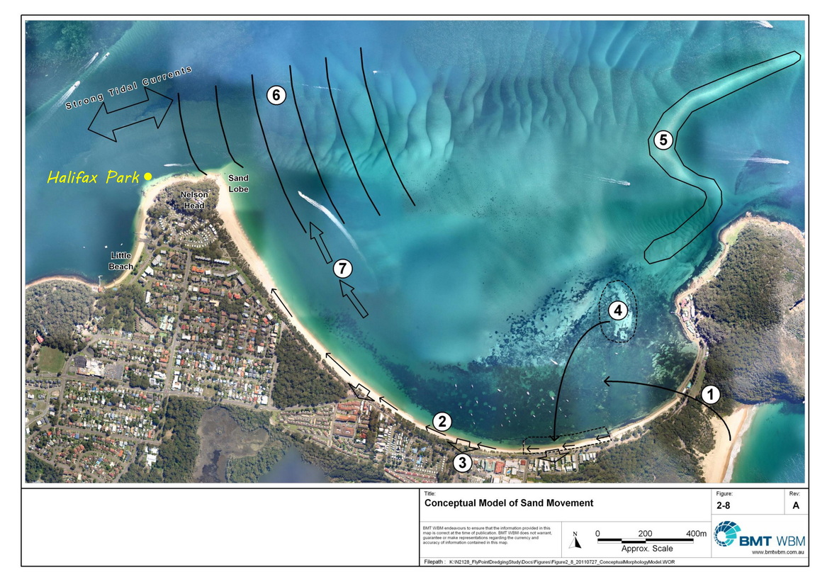 One school of thought being that the over-development along the southern shore is causing it.
The alternate view being “shifting sands” are a natural phenomenon in estuaries like Port Stephens. Which is why dredging is often required.
The best information I could find on-line about the actual movement of sand was the Halifax Park/Fly Point Sand Accumulation Study.
This report was authored by David Wainwright for BMT WBM and was commissioned by the Great Lakes Marine Park.
It made (for me…) interesting reading, but I will let you form your own judgement.
One thing is very clear though… Those shifting sands have effectively decimated one of the underwater wonders of Nelson Bay!
Diving Nelson Bay – Pipeline
Located near the breakwall of the Nelson Bay marina. This site takes its name from the disused former sewerage pipe which extends well out into the east lobe of Port Stephens.
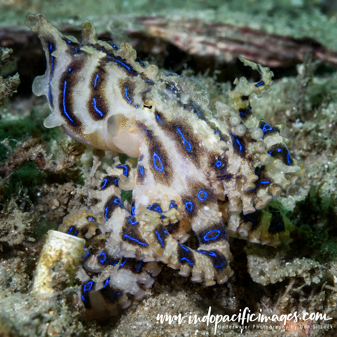
It enjoys a stellar reputation as great place to see and photograph an incredible number of critters. Such as numerous species of nudibranchs, pipefish, seahorses, eels and the occasional weird and wonderful tropical critters!
Concrete steps and a handrail have been provided about 25m to the east of the disused sewer pipe. Making entry and exit to the site much safer and easier.
Once in the water, swimming over to the pipe provides an excellent way to initially navigate around the extended area.
The pipe heads out straight north into the east port for some 250m, to a depth of about 18m. So following it out and back again will ensure you don’t get lost as you get to know the lay of the land!
There is a great selection of macro subject along the full length of the pipeline.
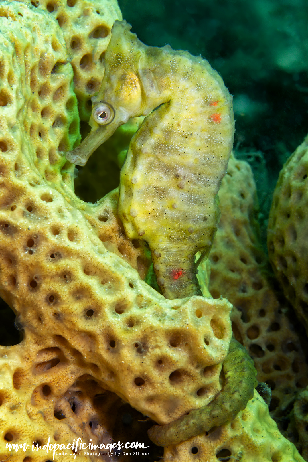
Pipeline was also home to Dawn – the oldest known White’s seahorse (Hippocampus whitei) in Australia. Typical lifespans for these creatures are believed to be between 3-5 years.
But Dawn managed almost 8 years, with most of them spent in the same spot at Pipeline! Interestingly, she also had the same partner for a number of years, who was christened Dusk…
Her age was known because she was marked with three small, red elastomer tags on the 8th March 2014. When, based on her size, her age was estimated at approximately 320 days.
She was last seen on the 19th April 2021 when her age would have been 7 years and 7 months. A period during which she enjoyed a degree of fame in the marine science community.
You can read more about Dawn in this paper by Nelson Bay based marine scientist David Harasti: Getting Old: An Endangered Seahorse (Hippocampus whitei) lives for up to 7 years in the wild.
Diving Nelson Bay – Fly Point
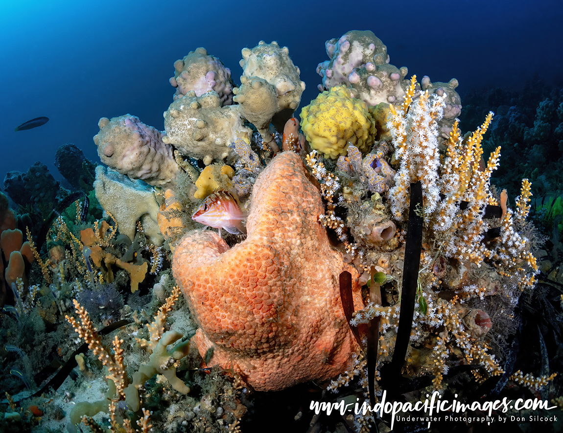
Opinions vary on whether this is the best site in Nelson Bay, but for me there is no argument… It’s the best because of it has a really special combination of macro life and superb sponge gardens!
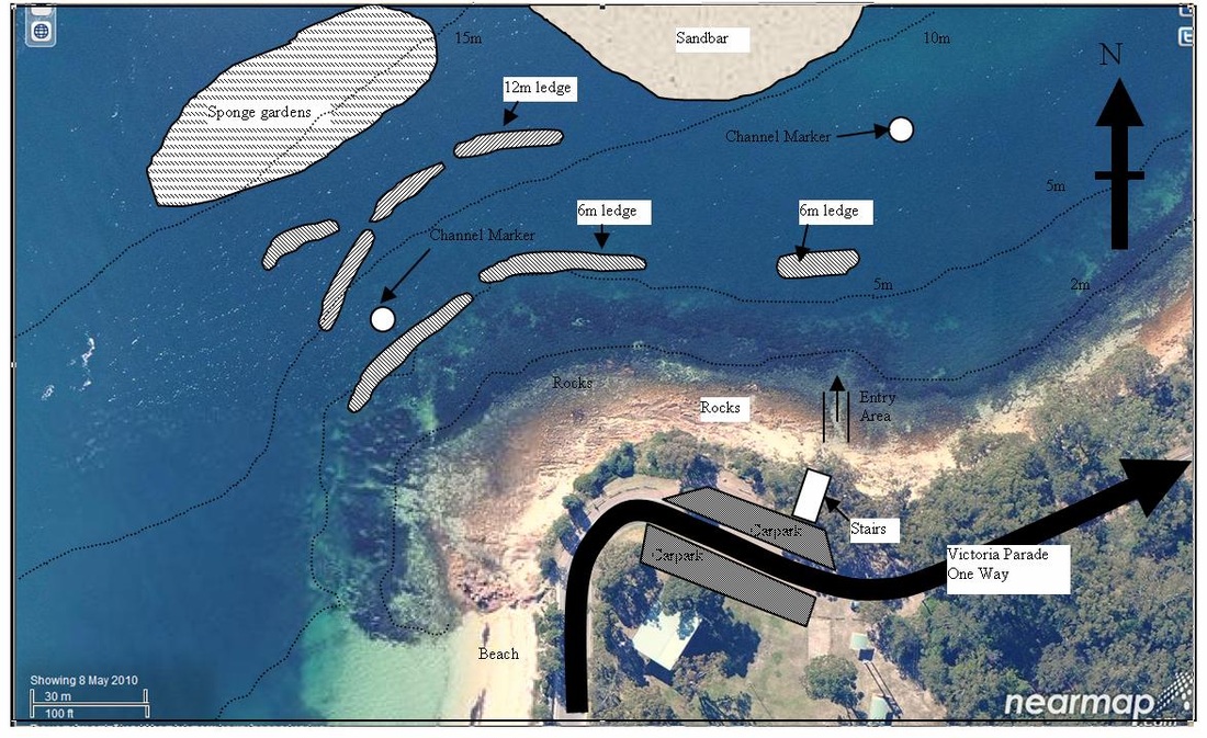
Fly Point is located at the northern end of Little Nelson Bay. And the main area of the site is around the rocky point and in the small bay just to the east.
There are a few ways to dive Fly Point, but they all involve the same initial swim straight north past the 4m wall at about 20m out. And then over the second slightly deeper wall another 20m on.
At this point you will be in about 6m of water, and you can either turn left and head west along that ledge which will take you to the tip of the rocky point. On the way there is much to explore in the kelp and the nooks and crevices along the wall.
This is definitely the best option if you have not dived Fly Point before. The navigation skills required are minimal and yet there is still a great deal of marine life to see.
Or you can take the more adventurous option and keep going north till you are in 12m. Then turn left to head west towards the rocky point.
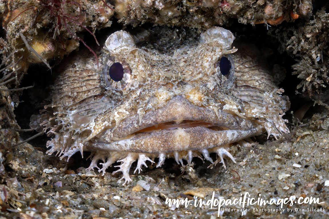
On the way you will find series of ledges, also in about 12m, where there is almost always a lot of fish patrolling mid-water. While under the ledge are a plethora of bethnic species plus shy creatures like Toadfish and Pineapplefish.
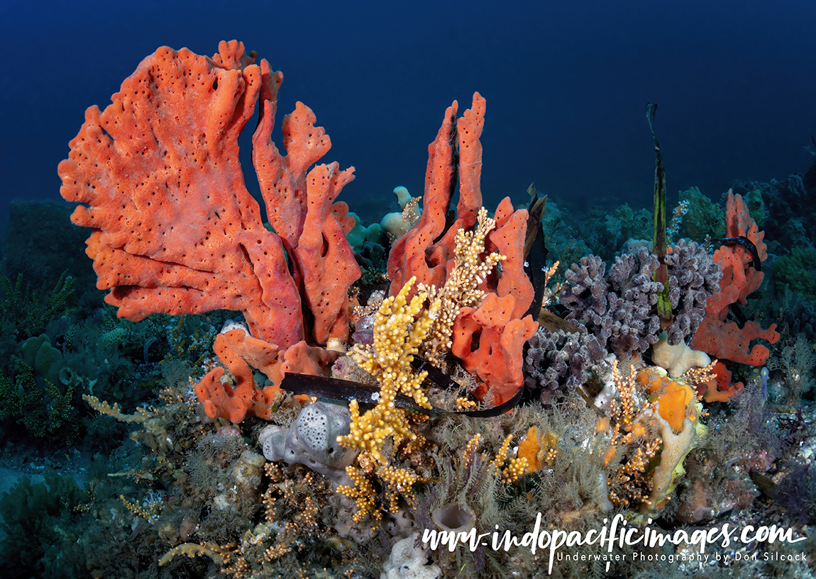
Just north of those ledges and in about 16m of water is my favourite part of Fly Point… The rich and incredibly beautiful sponge gardens!
While the sponges themselves are prolific and very photogenic, they are also host to a great variety of fish and critters and spending time there is basically why I like Nelson Bay so much!
When to Dive Nelson Bay
Nelson Bay is a year-round diving location, although conditions can and will vary throughout the year.
Visibility: On a really good day, in-water visibilities of up to 15m have been known, but generally good for Nelson Bay is around 7-8m and bad is less than 1m. A great deal depends on the tide and recent rainfall and while it is possible to dive at low tide, it means the water will be full of the discharge from the Karuah River as it makes its way down the estuary…
Whereas a high tide means in-coming, much cleaner water from the Tasman Sea, particularly so when there is a southerly wind. Heavy recent rain almost guarantees terrible visibility because of the greatly increased particulate in the river discharge, and it can take several days for that to be flushed out to sea by the tides. So, as a general rule, plan your dive for the high tide because it provides the best chance of good visibility in Nelson Bay.
Water Temperature: As you would expect, the temperature varies through the year, falling as low as 16oC in late winter and early spring, from July through to September and rising to around 23 oC in February and March.
Marine Life: Studies by Reef Life Survey (RLS) have shown a strong correlation between warmer water and the amount of marine life. That is particularly so with the number and diversity of fish species which peak in later summer and early autumn as those temperatures also peak.
How to Dive Nelson Bay
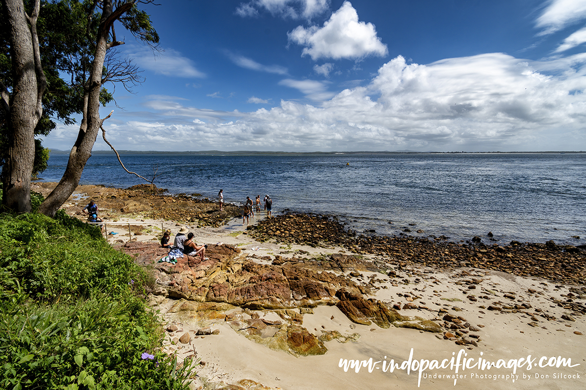
All the main sites in Nelson Bay are shore dives with easy entry and exits. Especially at Fly Point and the Pipeline where there are excellent steps and railings provided.
The main danger when diving Nelson Bay are the tides. And the only real option being to dive at high tide as trying to do so on a rising tide exposes you to the strong risk of being swept into the busy main channel and taken into the bay.
Worse still would be diving on a falling tide and the very real risk of being taken out to sea!
Most of the local divers opt for Sydney’s Fort Denson tide tables. Because of the time a time lag with the Port Stephens table and gets you in the water before the peak, giving you the optimum time in the water.
There are two local dive shops – Let’s Go Adventures and Feet First Dive. Both of which know the area extremely well and can provide all the support you might need.
In Summary…
Nelson Bay is for me a really special place. Relatively close to Sydney, but far enough away to have its own personality. The whole Port Stephens area is wonderfully scenic and very photogenic. Add in the great diving and it’s very easy to see why it is so popular.
Dived at high tide, both Pipeline and Fly Point offer some of the best shore diving in NSW!
Mentioned in Dispatches…
Special thanks to Meryl Larkin and Tom Davis of the DPI, along with Tim Austin of UNSW for helping me to better understand the complexity of Port Stephens!
Tom Davis also runs the Diving Nelson Bay website which contains a lot of useful information and is well worth checking out. As is Dave Harasti’s site www.daveharasti.com
Diving Nelson Bay – Scuba Diver Article
The Australian edition of Scuba Diver magazine recently published my five page Diving Nelson Bay article and you can use the link to download a PDF copy.
