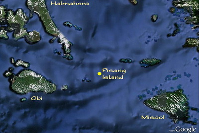
In the middle of the Halmahera Sea, roughly equidistant between Misool & Halmahera Island, is the banana shaped island called Pisang and the nearby two smaller islands called Batuanyer Kecil.
All three islands rise steeply from the deep waters of the Halmahera Sea and are richly coated in dense vegetation.
Underwater the two Batuanyer Islands are connected by a reef which is extremely vibrant and covered in hard & soft corals in a kind of mirror image of the dense vegetation above water.
All three islands sit right in the path of the Indonesian Throughflow.
As the waters pass around the islands, their shapes & underwater topography produce the perilous downdrafts that are a constant potential danger when diving the best sites in Indonesia.
Diving such locations requires a rapid negative entry whereby everybody in the dive tender is geared up and ready to go – the tender then positions itself up-current of the site and on a signal the engine is killed and everybody rolls backwards at the same time, grabs cameras and the gets down quickly before the currents take you away…
The trick is to get to the front of the site where the current hits it, central enough and deep enough to avoid being pulled to the side or taken over the top by the flow of water. This is where the effect of the current is reduced and the best action is to found, plus further down is often where the “big dogs” can be found.
[slideshow id=91]
Pisang and Batuanyer Islands Image Gallery
Diving Indonesia: South Halmahera Dive Sites – Joranga Island

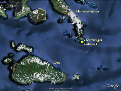
At the southern tip of Halmahera are two medium sized islands, the most southern of which is called Joranga.
The reefs on the southern side of Joranga are touched by both the Indonesian Throughflow, and the flow of water that comes down through the Patintie Strait, between Halmahera and the large island of Bacan.
Expectations of these reefs was therefore pretty high, but the ones we dived around the villages of Karang Dorobi, Ganone & Nenas were a big disappointment as they were in very poor condition.
The reef at Karang Dorobi appeared to have been severely damaged by a major storm at some time in the past which had wiped out the coral over hundreds of meters.
The reef just round from Ganone village, was also not in very good condition apart from the shallow water hard coral gardens near the mangroves.
Nenas was a muck site with the classic traits of a sheltered bay, small river and cold upwellings from the nearby deep water.
[slideshow id=92]
Joronga Island Image Gallery
Next Page: South-West Halmahera Dive Sites
Back To: Halmahera Scuba Diving Overview
