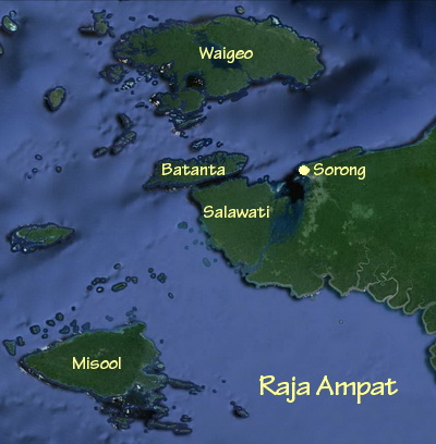
The island of Misool in southern Raja Ampat is the second largest of the Four Kings and its surrounding waters has some of the best diving in all of Raja Ampat – with several of the reefs in the south-eastern archipelagos so good, many consider them to be the best in the world!
Located some 150km south-west of Sorong in the Ceram Sea, Misool is a remote and sparsely populated area with no airport, major towns, roads or significant infrastructure.
Getting there usually involves an overnight journey by liveaboard or, if you are lucky enough to be staying at Misool Eco Resort, about 5 hours in their private speedboat.
The interior of the main island is rugged, heavily forested and uninhabited as the small population of less than 10,000 people are scattered around the coastline in about 15 main villages.
The dynamics of that small population are quite interesting as they are split into two fairly distinct groups, but share Misool’s unique language, with the first grouping consisting of those who used to live in the interior of the island and are now mainly Christian.
Distinctively Papuan in appearance – having the characteristic frizzy hair, dark skin, flat noses and wide mouths – they live a subsistence lifestyle from farming and hunting inland.
The second grouping are those who have always lived close to the coast and have traditionally mixed with people from Maluku to the south and have the straight hair, softer features and lighter skin of the Malukans. They are mostly Muslim and rarely venture in land, having always make their living from the sea.
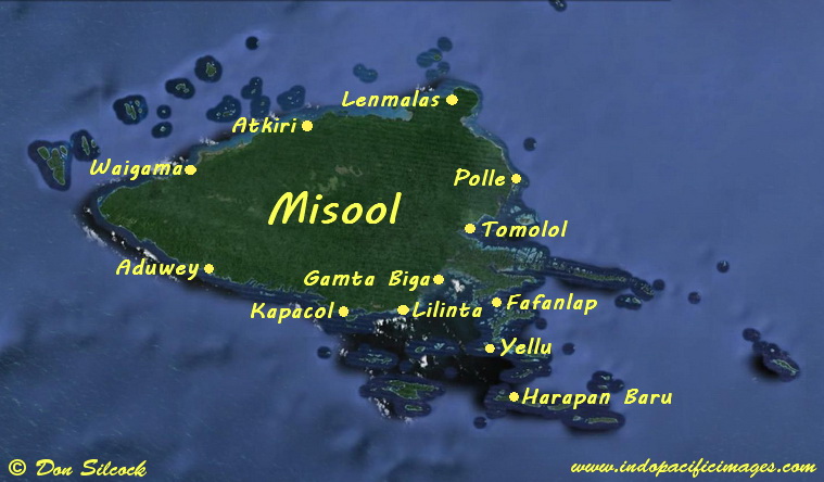
Map of Misool showing the main villages on the island
Misool and its archipelagos cover a total area of around 2,000km², with the highest point being on the main island and reaching close to 560m.
Probably the most defining feature of Misool are the spectacular and largely uninhabited islands of its two eastern archipelagos – Sagof-Dalam to the north and the Southern Archipelago to the south.
Their karst limestone composition means some incredible shapes have been created by the ages and their setting in the clear waters of the Ceram Sea makes them visually stunning.
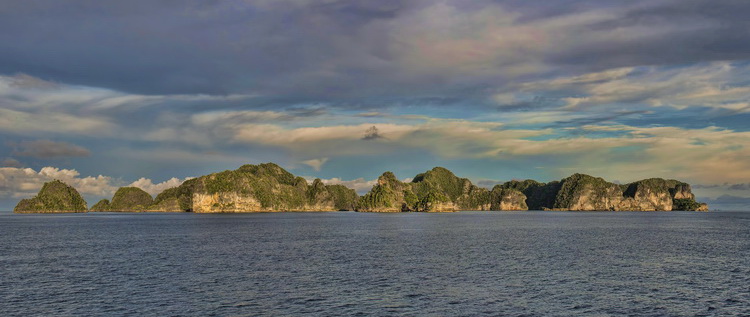
Islands in the Sagof-Dalam Archiplelago