
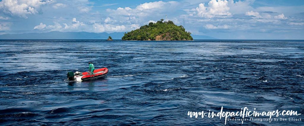
The Indonesian Throughflow… beneath the islands of Indonesia, an immense invisible river flows between two oceans.
Known as the Indonesian Throughflow. This vast movement of water transfers enormous volumes from the Pacific Ocean into the Indian Ocean. Passing through the labyrinth of islands and deep-water passages that form the Indonesian archipelago.
It is the only place on Earth where tropical oceans are connected in this way, and its influence extends far beyond Indonesia itself.
The Throughflow helps regulate global climate and redistribute heat across the planet. It drives nutrient-rich upwellings, and powers the extraordinary marine biodiversity of the Coral Triangle — the richest concentration of marine life on Earth.
For divers, underwater photographers and marine scientists alike, the Indonesian Throughflow is the hidden force that explains why Indonesia has become the global epicentre of tropical diving.
The Indonesian Throughflow – The Ocean’s Hidden River
Although few people outside oceanography have heard of it, the Indonesian Throughflow is one of the most significant oceanic processes on the planet.
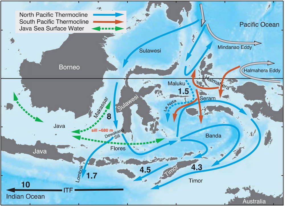
Driven primarily by differences in sea level and water density between the Pacific and Indian Oceans, massive volumes of water are continuously forced through the Indonesian archipelago. Estimates suggest the Throughflow transports approximately 15 million cubic metres of seawater every second.
Oceanographers measure these immense flows in Sverdrups — a unit equal to one million cubic metres per second. By comparison, all the world’s rivers combined discharge only around one Sverdrup into the oceans. The Indonesian Throughflow averages around fifteen.
This enormous transfer of water influences global ocean circulation, climate systems and marine productivity across the Indo-Pacific region.
Why the Water Moves
The primary driver of the Indonesian Throughflow is the difference in sea level between the western Pacific and eastern Indian Oceans.
Trade winds push warm tropical surface water westward across the Pacific, causing water to accumulate against the islands of Southeast Asia. Sea levels in the western Pacific can be significantly higher than those in the eastern Indian Ocean, creating a natural pressure gradient.
The water then seeks equilibrium by flowing southward through the Indonesian archipelago via a complex network of deep channels, narrow straits and semi-enclosed seas.
The principal pathways include the Makassar Strait, Lombok Strait, Ombai Strait, Timor Passage and the Lifamatola Passage. And as the water squeezes through these narrow passages, strong currents are generated. Currents that many divers experience first-hand in locations such as Komodo, Alor, Raja Ampat and Nusa Penida.
Visualising the Indonesia Throughflow
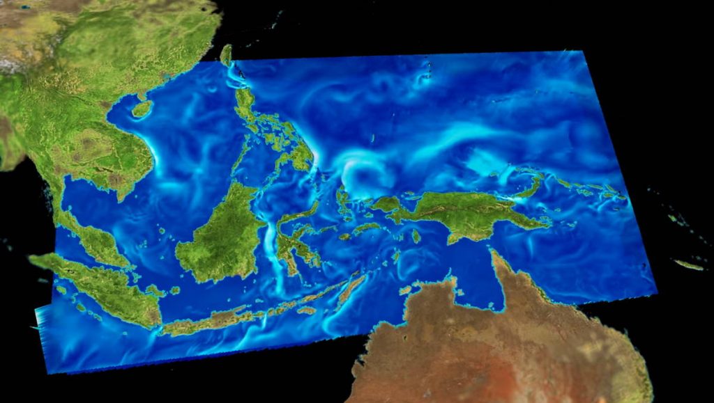
For a vivid visualisation, software engineer Scott Pearse of the National Center for Atmospheric Research in Colorado has produced an excellent Indonesian Throughflow animation, available on YouTube. It beautifully captures how this underwater highway moves through the archipelago – click on the image below to view the animation.
A Global Climate Regulator
The Indonesian Throughflow does far more than simply move water between oceans.
By transferring vast quantities of warm tropical water from the Pacific into the Indian Ocean. The Throughflow plays a major role in regulating heat distribution across the planet. It also influences monsoon systems, El Niño and La Niña variability, and long-term climate dynamics throughout the Indo-Pacific region.
Some researchers have even suggested that the enormous friction generated as water passes through the Indonesian archipelago may act as a subtle hydraulic brake on Earth’s rotation. A dramatic illustration of the sheer scale of the process.
While the precise magnitude of that effect remains debated, it highlights just how immense the Throughflow truly is.
Why the Indonesian Throughflow Creates Biodiversity
The Indonesian Throughflow is one of the principal reasons why Indonesia sits at the centre of the Coral Triangle — the global epicentre of tropical marine biodiversity.
The constant movement of water through the archipelago creates a highly dynamic marine environment. Whereby nutrients are redistributed, egg and larvae are dispersed between reefs, plankton productivity increases and coral ecosystems receive continuous replenishment
These processes support extraordinary concentrations of marine life, including more than 600 species of reef-building coral. Over 2,500 species of reef fish plus large pelagic populations, dense schools of reef fish and exceptional macro biodiversity
Few places on Earth demonstrate this more dramatically than Raja Ampat. Where nutrient-rich currents sustain astonishing reef biomass and fish abundance.
Upwellings — Indonesia’s Natural Fertiliser System
One of the most important effects of the Indonesian Throughflow is the creation of upwellings.
As currents interact with steep underwater topography, colder nutrient-rich deep water is pushed toward the surface. These nutrients act as a natural fertiliser system, stimulating plankton growth that supports the entire marine food chain.
This process explains many of Indonesia’s most famous diving phenomena:
- The dense fish biomass of Raja Ampat
- The powerful currents of Komodo
- The cold-water upwellings around Bali and Nusa Penida
- Seasonal aggregations of pelagic species
- Exceptional soft coral growth in eastern Indonesia
The famous mola mola encounters around Nusa Penida are closely linked to these seasonal cold-water upwellings generated by the Throughflow system.
For divers, the currents can sometimes be challenging… But those same currents are also the reason Indonesia’s reefs are so vibrant and alive.
The Indonesian Throughflow and the Wallace Line
The Indonesian Throughflow also helps explain one of the world’s most remarkable biogeographic boundaries — the Wallace Line.
In the 19th century, British naturalist Alfred Russell Wallace spent 8 years (1854 to 1862) exploring what was then known as the Malay Arcipelago – today’s Indonesia. In the process he collected some 125,660 specimens of the flora and fauna of the area.
Wallace observed a dramatic difference in animal species between the western and eastern parts. Specifically, to the west of the line he found organisms related to Asiatic species. While to the east, there was a mixture of species of Asian and Australian origins present.
In 1859 Wallace envisioned a line drawn north to south through the archipelago, which later became known as the “Wallace Line” that illustrates that west to east difference.
Modern oceanography and geology suggest that the deep-water channels and strong currents associated with the Indonesian Throughflow helped reinforce this evolutionary divide over millions of years.
Even during periods of lower sea levels, deep-water barriers between the islands remained, limiting species migration.
Today, the Wallace Line remains one of the clearest examples of biogeography on Earth — and another reminder of how profoundly oceanography shapes life itself.


The Pulse of the Coral Triangle
The Indonesian Throughflow is ultimately more than a current. It is a planetary-scale life-support system that connects oceans, climates, ecosystems and species across the Indo-Pacific.
Invisible beneath the surface, it powers the Coral Triangle itself. Shaping reefs, feeding marine life and sustaining one of the most biologically rich regions on Earth.
For those fortunate enough to dive Indonesia’s waters, every current-swept reef and every explosion of marine life is a reminder that the Throughflow is always present. Silently moving between two oceans and breathing life into the heart of the Indo-Pacific.