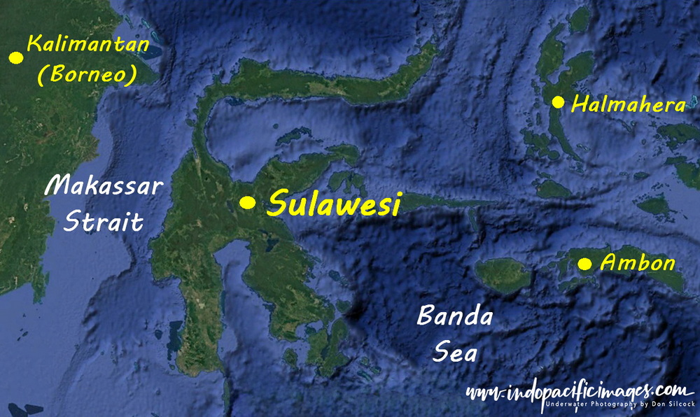
Understanding Sulawesi begins with its unusual shape…
With the third largest island in Indonesia laying like a fractured star at the heart of the archipelago of 17,000+ islands that form the nation.
But beyond its unusual geography, Sulawesi stands apart for another reason.
It offers one of the most compelling combinations of diving, biodiversity, and cultural diversity anywhere in Indonesia.
For divers in particular, understanding Sulawesi is a key part of understanding why diving in Indonesia is so exceptional.
People & Culture
Sulawesi has many stories to tell – home to approximately 15 million people, around 80% of whom are Muslim and are primarily concentrated in the south among the Makassarese and the seafaring Bugis.
Further north and inland, the island becomes more diverse, with central Sulawesi home to the animist-Christian Toraja, while in the north there are the nine tribes of the predominantly Christian Minahasa people.
This cultural diversity mirrors the island’s extraordinary natural contrasts – both above and below the waterline.
Understanding Sulawesi – Early History & European Influence
The Portuguese were the first Europeans to reach the East Indies in the early 16th century, drawn by the lucrative spice trade centred in the Moluccas.
Within a few years, they extended their reach to Sulawesi, naming it Ponto dos Celebres – often interpreted as “Cape of the Infamous Ones.” The name likely reflected the powerful and unpredictable currents they encountered, which caused numerous shipwrecks. Over time, “Celebres” evolved into “Celebes,” the island’s colonial-era name.
Today, we understand that those early sailors were grappling with the force of the Indonesian Throughflow – one of the most significant ocean current systems on the planet.
Alfred Russel Wallace & the Defining Line
No effort at understanding Sulawesi is complete without the work of Alfred Russell Wallace.
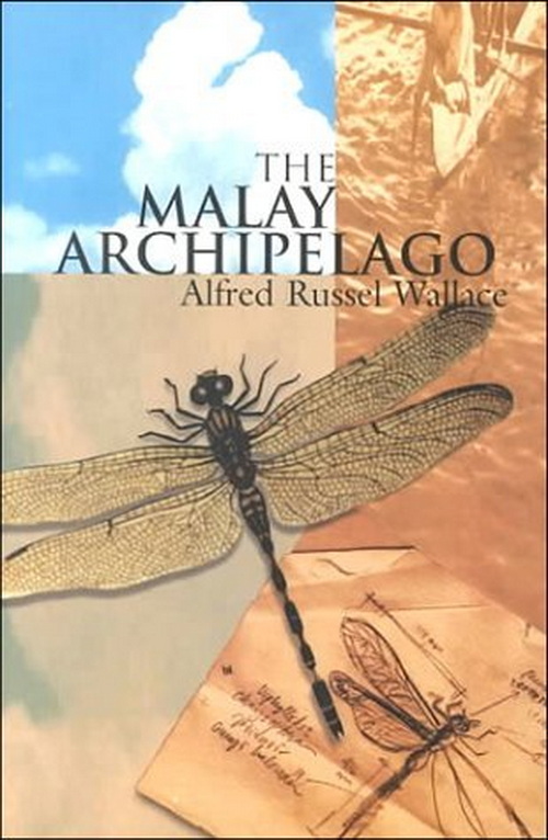
Between 1854 and 1862, Wallace spent eight years exploring what he called the Malay Archipelago, documenting its flora, fauna, and cultures in extraordinary detail.
His book, The Malay Archipelago, remains one of the most important natural history accounts ever written.
From more than 125,000 collected specimens and over 14,000 miles of travel, Wallace reached a profound conclusion – there was a fundamental biological divide within the archipelago.
He proposed an imaginary line running north to south, where to the west, species were of Asian origin (Indo-Malayan). And, to the east, they were Australasian (Austro-Malayan)
This boundary became known as the Wallace Line, one of the most significant biogeographical divisions on Earth.
The Wallace Line & Sulawesi
Wallace observed that the starkest contrasts occurred between Borneo and Sulawesi in the north and to the south between Bali and Lombok. Placing Sulawesi at the very heart of that divide and modern science has since explained why.
The Indonesian Throughflow, moves vast volumes of water between the Pacific and Indian Oceans, which creates a deep-water barrier that prevented species migration between these regions.
But that same process is also also the driving force behind the marine biodiversity of Sulawesi – and the reason why the region offers some of the richest diving environments on Earth.
Understanding Sulawesi, therefore, is not just about geography or history — it is about recognising how oceanography and evolution have combined to create world-class diving.
Understanding Sulawesi – Getting There…
Sulawesi has two main gateways with Manado in the north and Makassar (Ujung Padang) in the south
Manado, rebuilt by the Dutch in 1844 after a devastating earthquake, was visited by Wallace in 1859. He described it as “one of the prettiest in the East,” likening it to a garden of rustic villas.
That description feels a little distant today and modern Manado is functional rather than beautiful. But it serves as the primary access point to some of Indonesia’s best diving, including Bunaken and the Lembeh Strait.
Its key advantage is connectivity. With an international terminal, it allows direct access without routing through Jakarta or Bali.
Airlines such as SilkAir have historically linked Manado to Singapore, simplifying travel logistics.
Makassar, by contrast, is a major domestic hub with strong connections across Indonesia and onward links to the rest of Sulawesi.

Back To: Diving Sulawesi