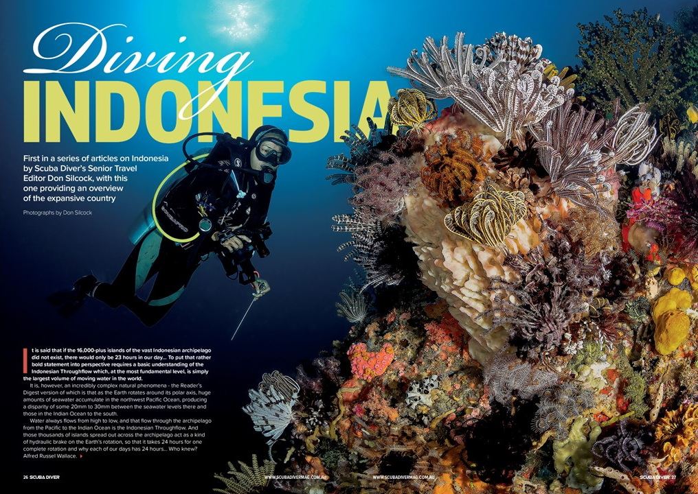
Diving Indonesia… It is often said that if the 16,000+ islands of the vast Indonesian archipelago did not exist, we would only have 23 hours in our day… To put that rather bold statement into perspective requires a basic understanding of the Indonesian Throughflow. Which, at the most fundamental level, is simply the largest volume of moving water in the world.
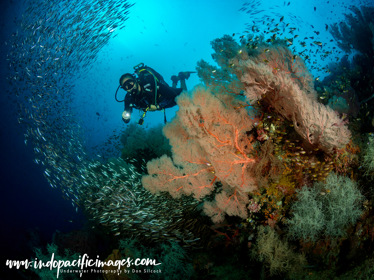
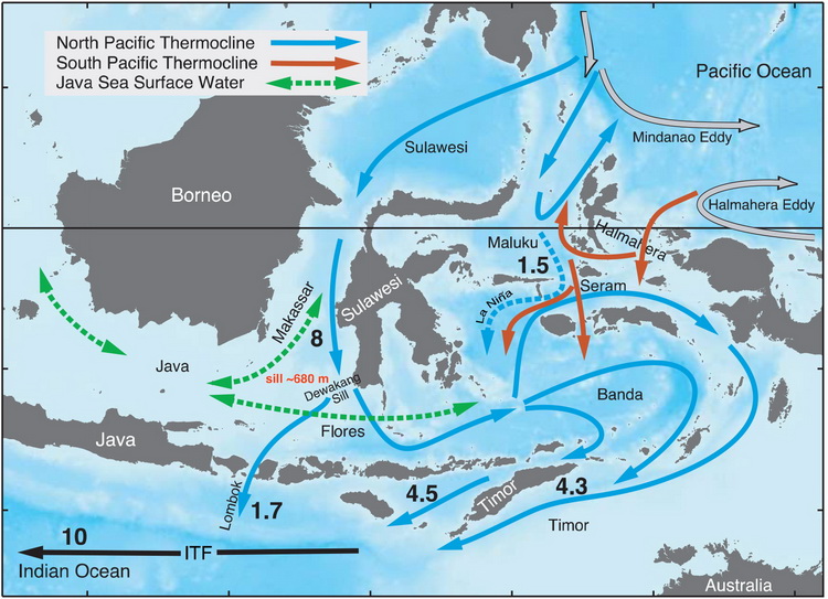
It is however an incredibly complex natural phenomena. The Readers Digest version of which is that as the Earth rotates around its polar axis, huge amounts of seawater accumulate in the northwest Pacific Ocean.
Producing a disparity of some 20mm to 30mm between the seawater levels in the northwest Pacific Ocean , and those in the Indian Ocean to the south.
Water always flows from high to low. And that flow through from the Pacific to the Indian Ocean is the Indonesian Throughflow.
And those thousands of islands spread out across the archipelago act as a kind of hydraulic brake on the Earth’s rotation. So that one complete rotation of the planet takes 24 hours to complete.
And therefore why each of our days has 24 hours… Who knew?
Alfred Russel Wallace …

Alfred Russel Wallace, the English biologist and explorer, was the first person to stumble on that phenomenon. Wallace spent 8 years in the 1850’s exploring what was then called the Malay Archipelago.
Over 160 years after it was published, his seminal book of the same name is still tremendous reading. And, if you want to understand more about this very special part of the world, use the link to download a PDF copy.
Wallace was a contemporary of Charles Darwin. And, around about the same time as Darwin was having his Origin of the Species “ah ha moment” in the Galapagos, Wallace was having his own revelation in what is now Indonesia.
As he made his way through the main islands of the archipelago. Wallace realised that the flora and fauna he was meticulously documenting were different in the east and the west.
But did not know why and had no way of finding out…
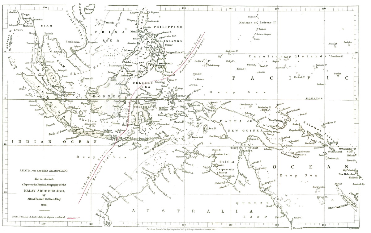
Instead, he drew what became known as the “Wallace Line” on a map of the archipelago. Denoting where the difference in flora and fauna was most apparent.
Wallace had no way of knowing it. But the line that he drew is basically the main path of the Indonesian Throughflow as those waters of the northwest Pacific Ocean make their way south to the Indian Ocean!
The massive flow of water creating a physical barrier that had separated the flora and fauna of the east of the archipelago from those in the west.
Nature’s Supply Chain
When the creatures in our oceans die, they sink to the bottom and decompose. Where they become part of the dense layer of detritus on the seabed. Rich in nitrogen and phosphorous, that detritus in the northwest Pacific Ocean is sucked up from the depths by upwellings created by the Indonesian Throughflow as it flows toward land.
Thus, does life in the ocean come full circle. As the nutrient rich remains of those dead organisms are delivered to the living ones hungry for sustenance. And then, as the waters of the Throughflow head south through the archipelago. The eggs and larvae of those reefs and ecosystems are transported and distributed through the archipelago. It’s basically a perfectly evolved supply chain brought to us by nature!
Where to Dive in Indonesia…
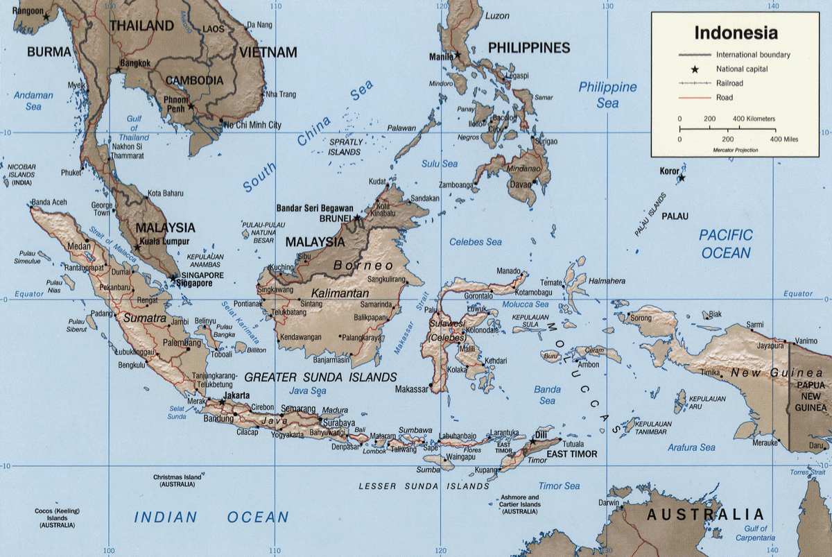
To understand where to dive in Indonesia, simply follow that supply chain through the archipelago. And look for where it touches land… With it all starting where the Throughflow makes first contact in Raja Ampat.
Diving Indonesia – Raja Ampat
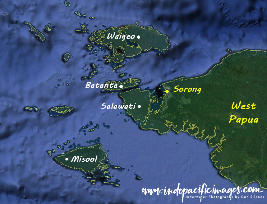
Raja Ampat is located on the western tip of the huge island of New Guinea. And is very much the crown jewel of the area often referred to as the Bird’s Head.
Raja means king in Bahasa Indonesia and Ampat is four. And those kings are the large four the main islands of Waigeo, Salawati, Batanta and Misool.
Now a self-governing regency, the total area of Raja Ampat covers some 40,000 km² of water with about 1500 smaller islands. The regency is roughly the same size as Taiwan.
New Guinea is the second largest island in the world after Greenland. And was divided in two by the colonial powers that came to the archipelago in the mid-16th century looking for the source of the fabled spice trade.
The eastern half now forms the mainland of the independent country of Papua New Guinea. And the western half is the Indonesian province of West Papua.
At the peak of the diving season from November through to February up to 100 liveaboards operate in Raja Ampat. While on land there are now some 20 land-based dive resorts. Yet, as recently as the mid-1990’s, there was just one liveaboard and one beach camp offering diving there!
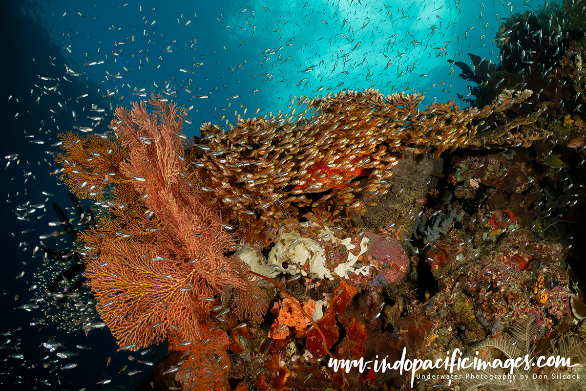
What drove that exponential growth and continues to draw divers to the area is it’s incredible marine biodiversity. With Raja Ampat widely acknowledged as probably the best tropical diving in the world. It truly is stunning underwater. With surveys of the area identifying over 600 species of hard coral (nearly 75% of the world’s total) and over 1700 species of reef fish – more than any other similarly sized region on the planet!
Diving Indonesia – Halmahera
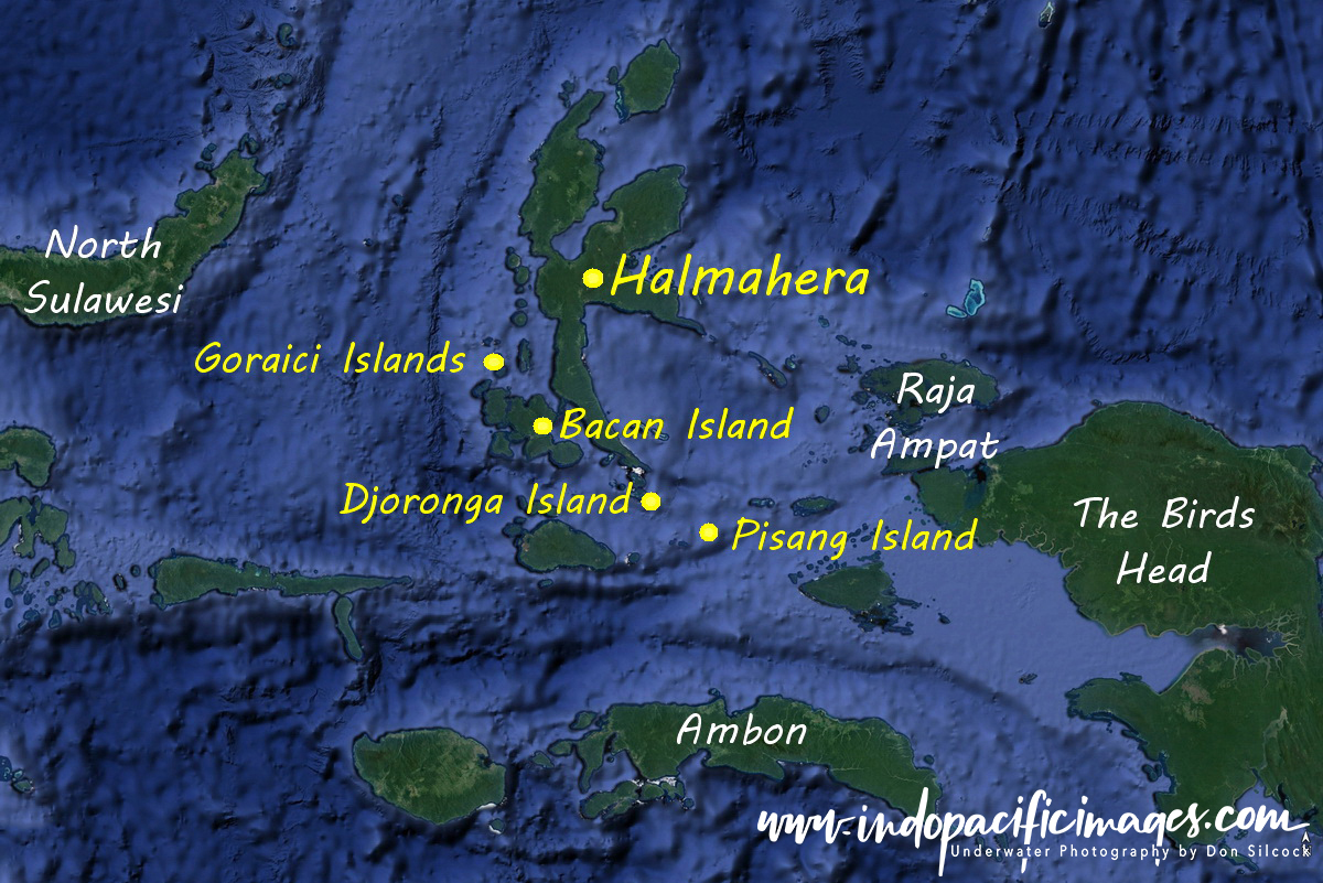 The large, starfish shaped island of Halmahera is located roughly halfway between West Papua and Sulawesi in the far north of the archipelago.
Remote and sparsely populated for its size. The island is swept on all sides by the Indonesian Throughflow and should have marine biodiversity approaching the levels of Raja Ampat. It most probably did at one time… But dynamite and cyanide fishing, the twin scourges of the archipelago, have wrought horrendous damage to large areas around Halmahera.
There are still some excellent areas to dive. But they are remote and mainly accessible from a liveaboard as land-based diving is limited – but growing now that the pandemic has (hopefully…) passed.
Almost no liveaboards do dedicated trips around Halmahera. Instead those that follow the monsoonal weather patterns and transit through the area on the way from Raja Ampat to North Sulawesi are the way to go.
That said those locations that can be reached, like Djoronga Island on the southern tip of Halmahera. And the Patintie Strait between Halmahera and the large island of Bacan offer some great diving. Similarly the journey from Raja Ampat to Halmahera, and from there to North Sulawesi offer the chance to dive the very remote and exciting Pisang (banana..) Island in the middle of the Halmahera Sea. And the Goraici Islands in the Molucca Sea.
Diving Indonesia – Sulawesi
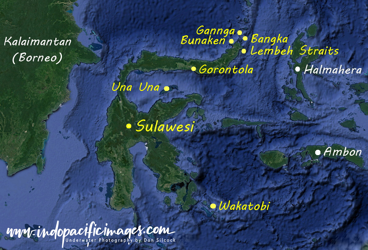 Roughly the size of the south island of New Zealand, Sulawesi sits right in the path of the Indonesian Throughflow. And its western coastline is effectively the last landmass on the Austro-Malayan Division (eastern) side of the Wallace Line.
Known in Wallace’s time as the Celebes, Sulawesi is probably best known for the seafaring Bugis of the south near Makassar. Their locally built Pinisi wooden schooners have been used for centuries to follow the monsoonal trade winds around the archipelago.
While trading was their main game, they also indulged in a significant amount of sea piracy.
They were also much feared by the European explorers. And are the source code of the English saying “watch out for the boogey man” are the Bugis…
Both North and South Sulawesi have some really great diving. But the north is more well known because of the excellent diving to be had in the Bunaken Marine Park on the western side of the tip of North Sulawesi. Together with the incredible exotic critter diving in the Lembeh Strait on the eastern side.
Plus, further north are the islands of Bangka and Gannga which also have great reputations for excellent diving. While to the south are the Gorontola, Una Una and the very upmarket and expensive Wakatobi dive resort.
Diving Indonesia – Maluku
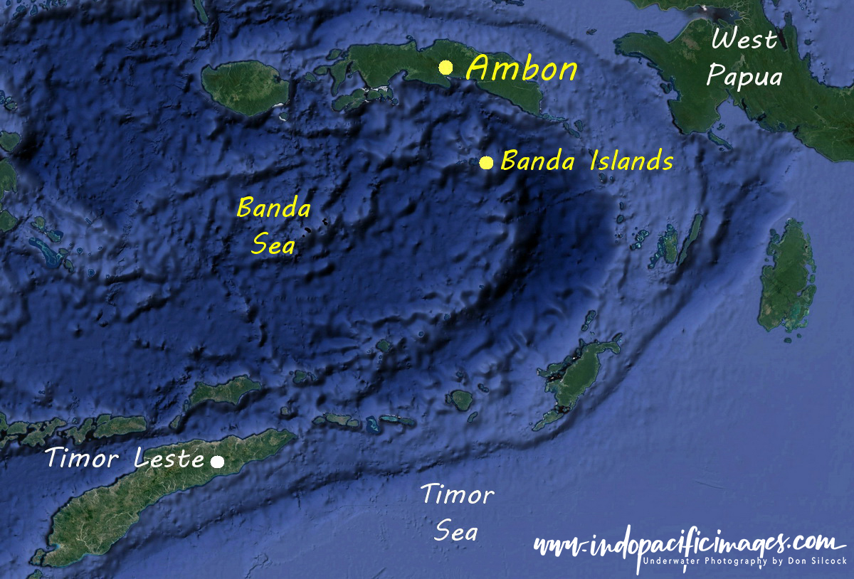 Formerly known as the Moluccas, the islands of this province were what the European explorers were looking for when they came searching for the “spice islands” of the East Indies.
First to arrive were the Spanish and the Portuguese… But they were supplanted by the Dutch with their bigger ships and better guns. And then the British turned up and made their presence felt…
But the Dutch ultimately prevailed. With their East Indies Company effectively ruling the archipelago until the independent country of Indonesia emerged after WWII.
Back in the 16th century cloves, nutmeg and mace were the only way to flavour and preserve meat. They were also perceived to offer a degree of protection from the deadly plagues that regularly ravaged Europe. Almost as valuable as gold, fortunes were made trading those rare and exotic spices.
The only place in the world they grew was on the very remote Banda Islands. And those European explorers wanted to to find those islands and control the source of the spice trade. Cutting out all the Arab and Venician spice trade merchants with their greatly inflated prices.
The city of Ambon on the island of the same name is the provincial capital. With the large bay that forms the entrance to its natural harbour offering excellent critter diving. While the south coast of the island has some really nice wide-angle diving.
To the south are the Banda Islands which are a quite special and unique diving location. And the huge Banda Sea offers the possibility of some amazing encounters with blue and sperm whales. Plus schooling hammerheads and the isolated sea snake infested Gunning Api “snake island”.
Diving Indonesia – Bali, Nusa Penida and Nusa Lembongan
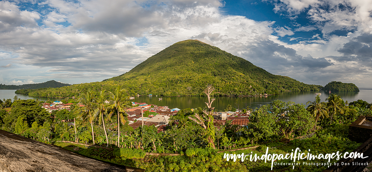
Where the Indonesian Throughflow touches the north and east coast of the Island of the Gods. And those of its close neighbours Nusa Penida and Nusa Lembongan, is where you will find excellent marine biodiversity.
Be warned though… The Lombok Strait, between Bali and the island of Lombok, is the main exit for the waters of the Indonesian Throughflow into the Indian Ocean. With the east coast of Bali experiencing some huge currents. With the islands of Nusa Penida and Nusa Lembongan sitting right in the middle of it! Most operators are well aware of the dangerous locations are and will avoid them like the plague… Make sure you do too!
The main locations for diving in Bali are Tulamben and nearby Amed on the north-east coast. Padang Bai on the east coast is also a very popular location. There are a few interesting critter diving spots further west from Tulamben. And on the western tip of Bali there is some good diving at Menjangan Island and the Secret Bay critter site at Gillimanuk.
Diving Indonesia – The Lesser Sunda Islands
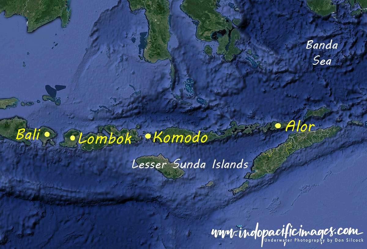 To the east of Bali are the chain of islands called the Lesser Sundas. Which effectively form the southern rim of the archipelago, with the area around Komodo being the main location for diving.
Komodo has experienced similar exponential growth in diving tourism as Raja Ampat. And the main town of Labuan Bajo is now virtually unrecognizable from what it was just 10 years ago.
Although it does get crowded and lacks the incredible biomass of Raja Ampat there is some really tremendous diving in the Komodo area.
Other locations in the Lesser Sundas are the south and east coasts of Lombok. The nearby islands of the Gilis have become the technical diving centre of Indonesia. While further to the east the area around Alor is known for great critter diving.
In Summary…
Trying to summarise the diving in Indonesia is like evaluating the length of a ball of string – it’s not an easy task. Understanding that massive flow of water through the archipelago is the key to knowing where to dive.
Follow the Throughflow and you will be on the right track and you won’t be disappointed!
Scuba Diver Article – Diving Indonesia
Scuba Diver published a six-page article of mine on Diving Indonesia and you can use the link to download a PDF copy.
